The Piri Reis Map has puzzled historians and explorers for centuries. Created in 1513 by the Ottoman admiral and cartographer Piri Reis, it offers a glimpse into the world of ancient navigation. What makes this map so captivating is its depiction of the Americas, especially the southern continent, with astonishing accuracy for its time. Some experts believe it shows the coastline of Antarctica—free from ice—long before it was officially discovered. Join us as we uncover the secrets behind this mysterious map and explore the theories that continue to intrigue researchers and enthusiasts alike.
Who Was Piri Reis?

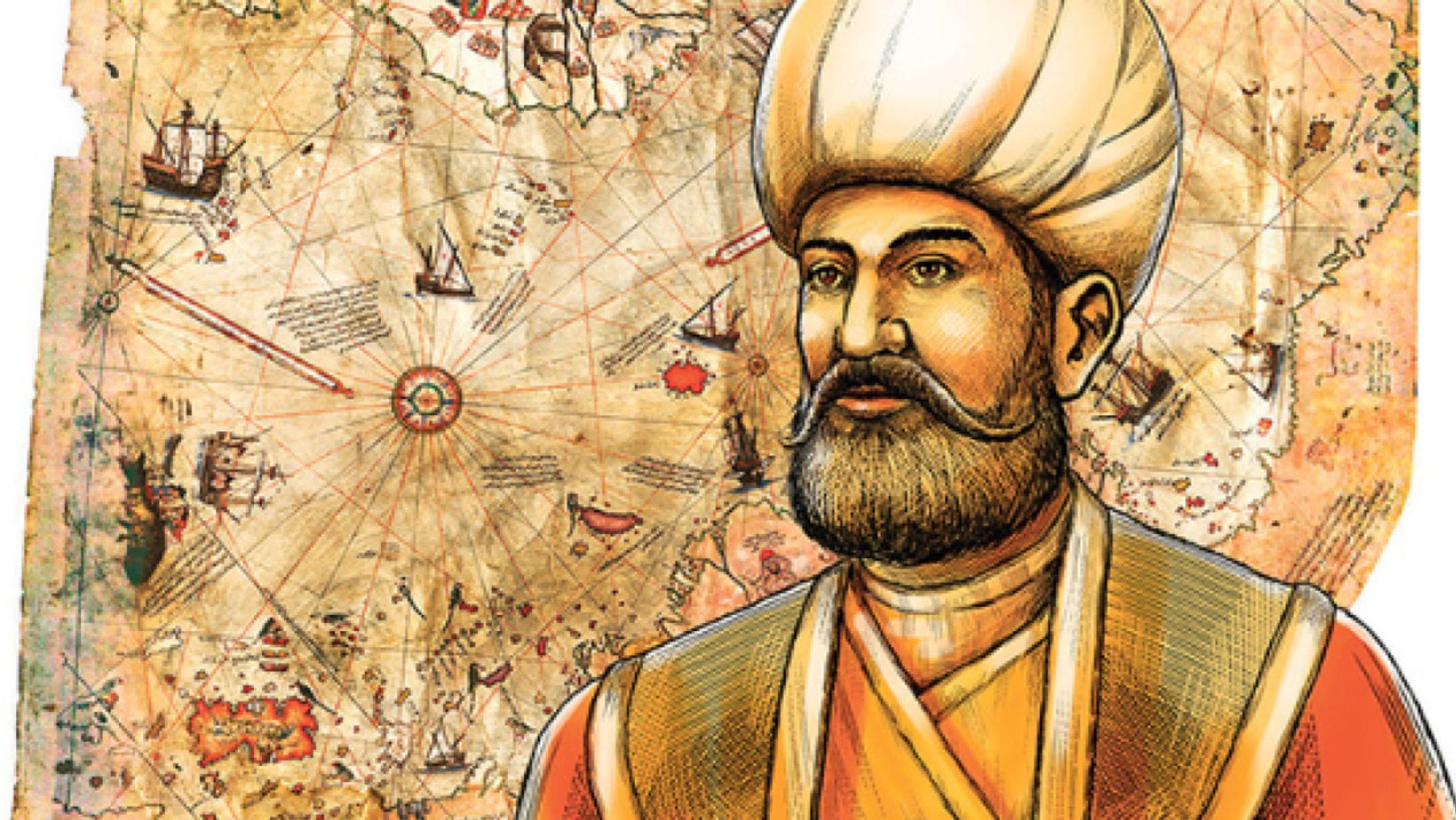
Piri Reis was an Ottoman admiral and cartographer who lived during the 16th century. He is best known for his world map, the Piri Reis Map, which includes parts of the Americas, Europe, and Africa. Born in 1465 in the Ottoman Empire, Piri Reis began his career in the navy, gaining recognition for his navigational skills. He later became a prominent cartographer, combining his maritime experience with his knowledge of geography.
Piri Reis’s map, created in 1513, is one of his most significant contributions to geography. It is famous for its detailed depiction of the South American coastline and parts of Antarctica, areas that were not well known to Europeans at the time. His maps were drawn using a mix of ancient sources, including Greek and Arab navigational charts, which influenced later European explorers. Piri Reis’s work demonstrated a sophisticated understanding of the world and is considered an important artifact in the history of cartography.
Throughout his career, Piri Reis contributed greatly to the Ottoman naval expeditions and was involved in various military campaigns. His legacy as a cartographer and naval officer continues to fascinate historians and geographers today. The Piri Reis Map remains a remarkable achievement, showcasing the intersection of exploration, science, and art during the Age of Discovery.
The Discovery of the Piri Reis Map
The Piri Reis Map was discovered in 1929 in the Topkapi Palace, Istanbul, by a Turkish naval officer named Halil Ethem. The map, made in 1513, was found among a collection of ancient documents. It depicts parts of Europe, Africa, and the Americas, with remarkable accuracy for its time. The map was created by the Ottoman admiral and cartographer Piri Reis, who compiled it from various sources, including ancient maritime charts.
Upon its discovery, the map immediately intrigued historians and cartographers. Its detailed portrayal of South America’s coastline and the clear depiction of the Antarctic continent, despite being unknown to explorers at the time, baffled experts. Some scholars initially dismissed it as a mere curiosity, but others began to delve deeper into its implications. The map sparked debates over its origins, accuracy, and the mysterious sources Piri Reis may have used.
The Piri Reis Map has been the subject of much speculation, with some suggesting it shows evidence of ancient advanced knowledge. It continues to captivate researchers and mystery enthusiasts alike. Over time, it has become an iconic piece in the study of ancient cartography. The discovery of the Piri Reis Map continues to challenge our understanding of history.
The Contents of the Piri Reis Map
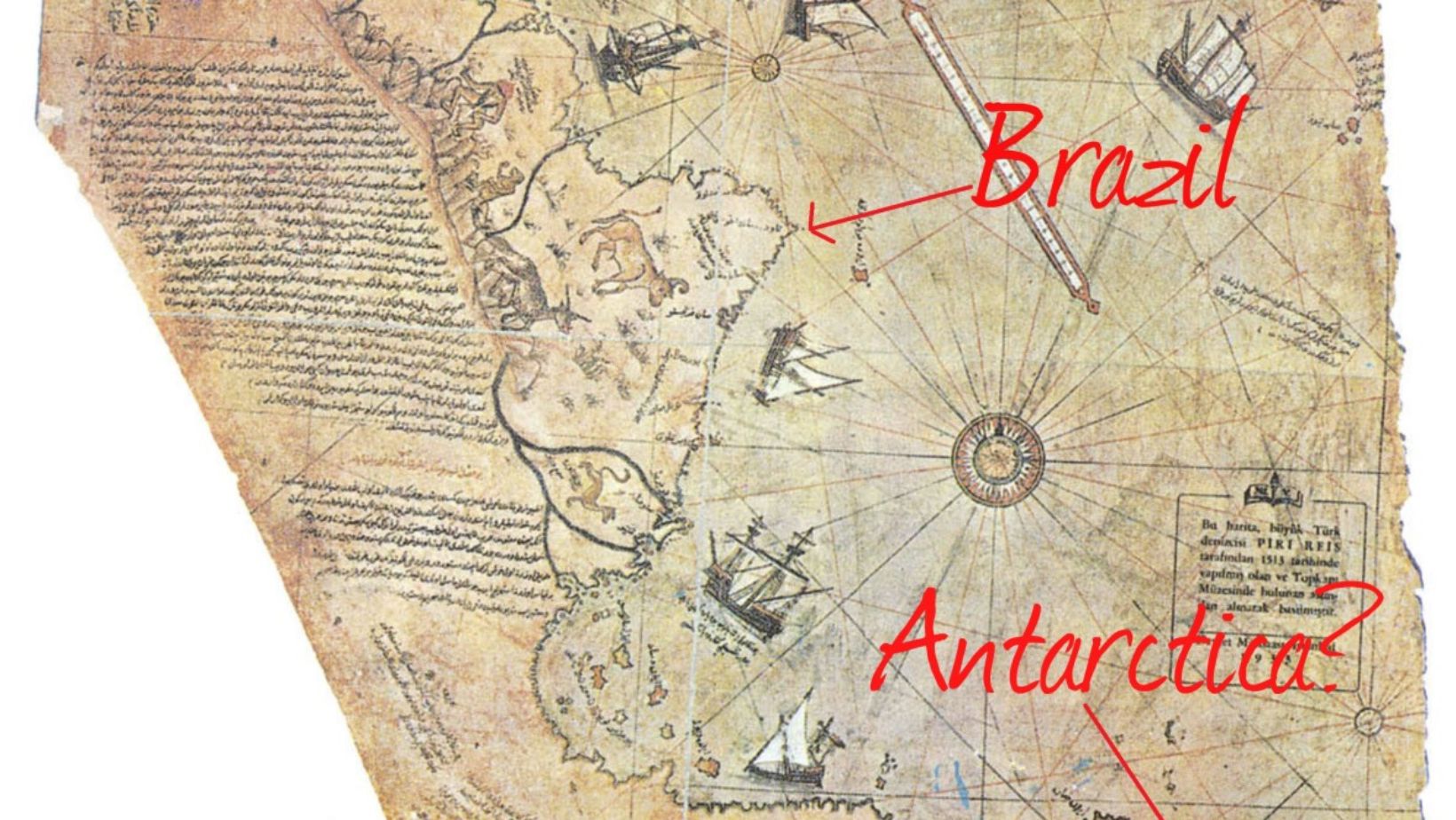
The Piri Reis Map, created in 1513 by the Ottoman admiral and cartographer Piri Reis, has fascinated historians and researchers for centuries. One of its key features is the detailed depiction of the South American coastline, particularly the northern part of Brazil. The map shows coastal outlines with remarkable accuracy, even more so than some modern maps from that era.
Another intriguing aspect of the Piri Reis Map is its depiction of Antarctica, a landmass that was unknown to the Western world at the time. The map shows a portion of the continent, suggesting it was once free of ice, which has sparked debates about the sources of Piri Reis’s information. Some believe he had access to ancient, lost maps or knowledge that predates his time.
The map also includes notable geographical features such as the African and European coastlines, along with islands in the Atlantic Ocean. Despite its age, the Piri Reis Map continues to be a subject of intrigue, with experts trying to decipher the origins of the knowledge it contains and the accuracy of its depictions.
The Piri Reis Map’s Representation of Antarctica

The Piri Reis Map, created in 1513, is famous for its remarkable depiction of the world’s coastlines. One of the most intriguing aspects of the map is its portrayal of Antarctica—without ice. This is especially puzzling because Antarctica was not officially discovered until the 19th century, and its coastline should have been unknown to mapmakers in the 1500s. The map suggests that ancient civilizations may have had advanced geographical knowledge long before modern exploration.
Several theories attempt to explain how the map includes an ice-free Antarctica. Some believe that ancient seafaring cultures had access to advanced cartographic knowledge lost over time. Others suggest that the map’s source could have been much older, potentially based on maps from earlier, unknown civilizations. Regardless of the theory, the Piri Reis Map continues to spark curiosity about the extent of ancient knowledge of the Earth’s geography.
The ice-free depiction of Antarctica challenges the traditional understanding of history and raises questions about the capabilities of ancient civilizations. Could they have known the continent’s shape before it was covered in ice? The Piri Reis Map remains a fascinating enigma, inviting further exploration and debate.
The Piri Reis map, created in 1513, is a remarkable artifact that continues to puzzle modern cartographers. Its detailed depiction of parts of the Americas, Europe, and even Antarctica suggests a level of accuracy that seems ahead of its time. The map is often hailed as a mystery because it includes precise geographic details, such as coastlines and mountains, that were not documented until centuries later. This challenges the belief that 16th-century cartographers had limited access to advanced geographical knowledge.
One of the most debated aspects of the map is its portrayal of Antarctica, which was not officially discovered until the 19th century. The map shows a portion of the continent, which is believed to have been covered in ice at the time. How 16th-century explorers could have known such details remains a mystery, prompting various theories about ancient lost knowledge or even extraterrestrial influence.
Despite extensive research, the accuracy of the Piri Reis map defies conventional explanations of cartography during that era. Modern technology, like satellite imagery and digital mapping, has yet to fully replicate the precision found on this 500-year-old map. As a result, the Piri Reis map continues to challenge our understanding of how ancient civilizations could have mapped the world with such remarkable accuracy.
The Map’s Accuracy: A Puzzle for Modern Cartographers
The Piri Reis map, created in 1513, is a remarkable artifact that continues to puzzle modern cartographers. Its detailed depiction of parts of the Americas, Europe, and even Antarctica suggests a level of accuracy that seems ahead of its time. The map is often hailed as a mystery because it includes precise geographic details, such as coastlines and mountains, that were not documented until centuries later. This challenges the belief that 16th-century cartographers had limited access to advanced geographical knowledge.
One of the most debated aspects of the map is its portrayal of Antarctica, which was not officially discovered until the 19th century. The map shows a portion of the continent, which is believed to have been covered in ice at the time. How 16th-century explorers could have known such details remains a mystery, prompting various theories about ancient lost knowledge or even extraterrestrial influence.
Despite extensive research, the accuracy of the Piri Reis map defies conventional explanations of cartography during that era. Modern technology, like satellite imagery and digital mapping, has yet to fully replicate the precision found on this 500-year-old map. As a result, the Piri Reis map continues to challenge our understanding of how ancient civilizations could have mapped the world with such remarkable accuracy.
Lost Continents: Theories of Prehistoric Civilizations
The Piri Reis Map, a 16th-century world map, has sparked intrigue due to its accuracy in depicting parts of the world that were unknown at the time. Some theorists believe it holds knowledge of lost continents, like Atlantis and Lemuria. These lands, though often considered mythical, have captivated the imagination of many. The map’s depiction of the coast of Antarctica, free of ice, has led to suggestions that ancient civilizations may have known about it long before modern discovery.
Atlantis is one of the most famous lost continents. Described by Plato, it was said to be a powerful civilization that sank into the sea. Lemuria, another legendary land, was theorized by 19th-century scientists to explain the distribution of species across the Indian and Pacific Oceans. While there is no conclusive evidence for the existence of these lands, they continue to fuel speculation and theories about prehistoric civilizations.
The Role of Ancient Explorers and Knowledge Transfer
Ancient explorers played a crucial role in sharing geographical knowledge across civilizations. Many early cultures, such as the Phoenicians, Greeks, and Egyptians, were known for their seafaring skills and ability to navigate vast oceans. They not only mapped their territories but also exchanged information about faraway lands. This knowledge was often passed through oral traditions, written records, and even shared with neighboring empires.
The idea of pre-Columbian trans-oceanic contact has been debated for centuries. Evidence suggests that ancient explorers may have reached distant lands, long before Columbus’ voyage in 1492. The Polynesians, for example, are believed to have sailed across the Pacific, reaching the Americas. Similarly, the Viking voyages to North America, centuries before Columbus, offer compelling evidence of early trans-oceanic contact.
Geographical knowledge transfer was essential for the advancement of early civilizations. The Silk Road, for instance, allowed not only for trade but also for the exchange of ideas, technologies, and maps. These interactions contributed to the spread of cultural and scientific knowledge, shaping the course of history.
The Piri Reis Map and Other Ancient Maps

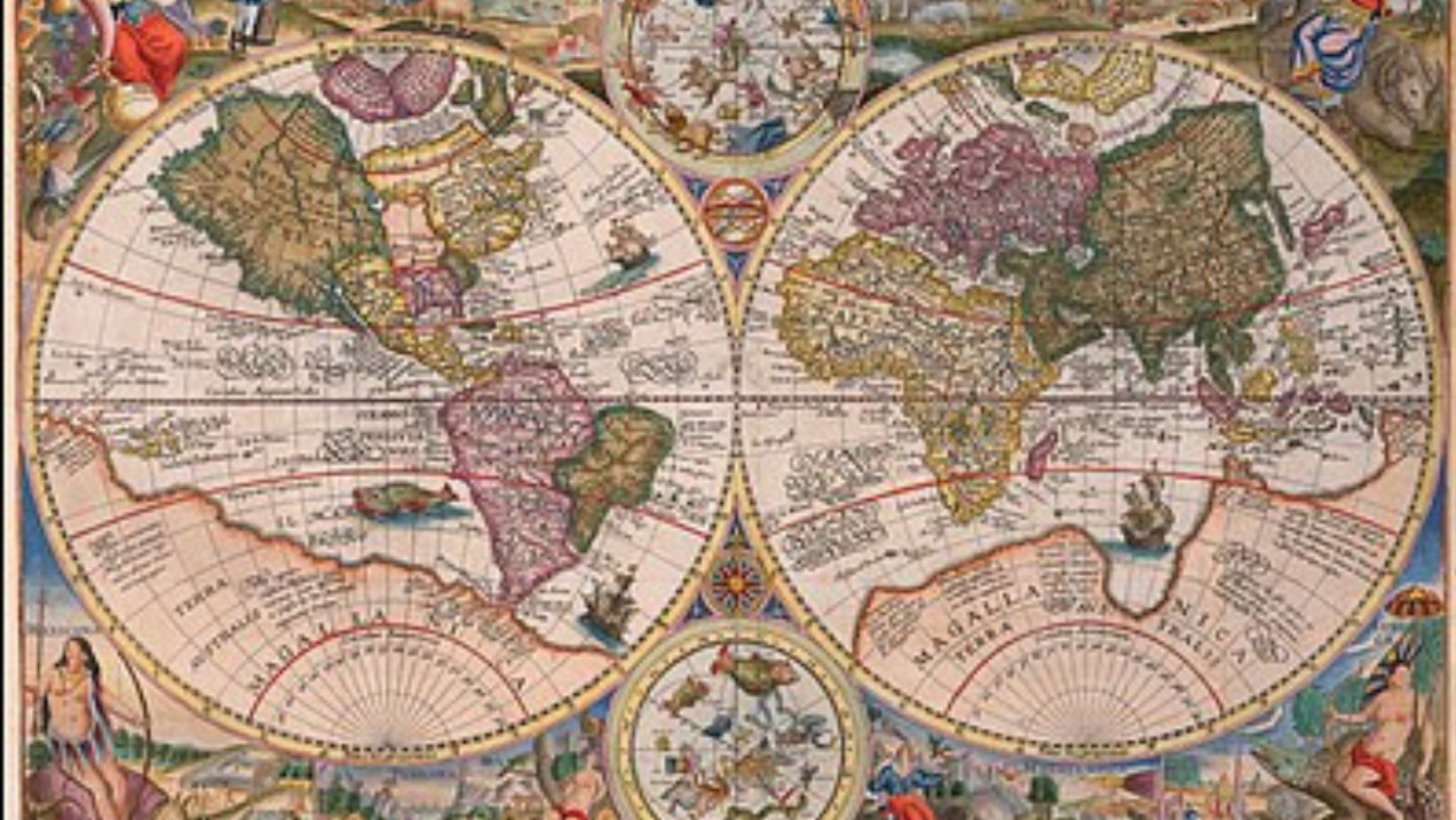
The Piri Reis Map, created in 1513, is one of the most famous ancient maps, known for its accuracy in depicting parts of the Americas and even Antarctica. When compared to other ancient maps, it stands out for its remarkable detail, especially considering the time period. Similarities between the Piri Reis Map and maps from other cultures, such as the Oronteus Finaeus map (1531), have sparked intrigue. Both show features like Antarctica’s coastline, which was not officially discovered until modern times.
The shared anomalies in these maps suggest that ancient civilizations may have had access to advanced geographical knowledge. Other ancient maps, like those from the Chinese or Greek traditions, also depict the world with surprising precision. Some researchers speculate that these maps were created using ancient techniques that have since been lost or forgotten. The mystery of how such accurate representations of distant lands were made continues to puzzle historians and cartographers alike.
These cartographic anomalies raise questions about the potential exchange of knowledge between ancient cultures. Whether through forgotten technologies or lost civilizations, the similarity of these maps hints at a more complex history of exploration. Unraveling these mysteries may reveal surprising truths about ancient knowledge and its transmission across the world.
Modern Interpretations and Controversies
The Piri Reis Map has sparked debates for centuries, with modern interpretations often divided into skeptical and speculative perspectives. Skeptics argue that the map is simply a product of 16th-century cartography, with its inaccuracies explained by the limited geographical knowledge of the time. They maintain that the map’s portrayal of the South American coastline is just a reflection of conventional map-making practices of the period.
On the other hand, speculative theories suggest the map contains ancient knowledge, possibly handed down by advanced civilizations or extraterrestrials. Some claim the map shows Antarctica free of ice, a feature that could challenge our understanding of historical geography. These theories propose that the map may have origins far older than the 16th century. While there is no conclusive evidence to support these claims, the allure of mystery continues to drive discussion.
Experts remain divided, with some defending the map as a product of its time, while others remain open to more fantastical explanations. The ongoing debate emphasizes the challenges of interpreting ancient maps and the mystery surrounding the Piri Reis Map’s true origins.
Conclusion: The Piri Reis Map: Ancient Knowledge of Lost Continents
The Piri Reis Map continues to captivate both historians and enthusiasts due to its perplexing accuracy and depiction of ancient lands. Its portrayal of parts of Antarctica, free from ice, raises intriguing questions about lost civilizations and forgotten knowledge. Despite various theories, the map’s origins and methods of creation remain elusive. This enduring mystery fuels speculation about the extent of ancient exploration and advanced cartographic skills. The Piri Reis Map challenges our understanding of history, inviting ongoing investigation into the possibility that ancient cultures possessed knowledge far ahead of their time. Its legacy persists as a symbol of the unexplained.
FAQs About The Piri Reis Map: Ancient Knowledge of Lost Continents
What is the Piri Reis map, and why is it famous?
The Piri Reis map is a 16th-century world map created by the Ottoman admiral and cartographer Piri Reis. It’s famous for its detailed depiction of parts of the Americas and Europe, especially the coastlines of South America. What makes the map extraordinary is its inclusion of what appears to be an accurate representation of the coastline of Antarctica—long before it was officially discovered.
How accurate is the Piri Reis map in terms of geographical representation?
While the map contains many accurate elements, it also includes unexplained anomalies. The map shows the coastlines of South America and Africa with surprising accuracy, especially considering the limited navigational technology of the time. More puzzling is the accurate portrayal of the northernmost part of Antarctica’s coastline, which was ice-covered and unknown in the 16th century.
Why does the Piri Reis map depict Antarctica without ice?
One of the most debated aspects of the Piri Reis map is its depiction of Antarctica’s coastline without the thick ice sheet that covers it today. Some theories suggest that ancient civilizations may have known about the continent before it became covered by ice, possibly indicating lost ancient knowledge or even a forgotten civilization with advanced geographical understanding.
Is the Piri Reis map evidence of ancient advanced civilizations?
Some researchers believe that the Piri Reis map hints at lost ancient civilizations with advanced knowledge of geography and navigation. The map’s details, especially the accurate portrayal of Antarctica, have led to speculations about civilizations existing long before the time of Piri Reis, possibly possessing knowledge that was later lost to history.
What sources did Piri Reis use to create his map?
Piri Reis claimed to have used a variety of sources to create his map, including ancient European charts and maps from explorers such as Columbus. The map is believed to have been compiled from many older documents, some of which might have contained knowledge passed down from ancient civilizations. However, the exact origin of these sources remains a mystery, fueling speculation about the sources of this detailed ancient knowledge.

