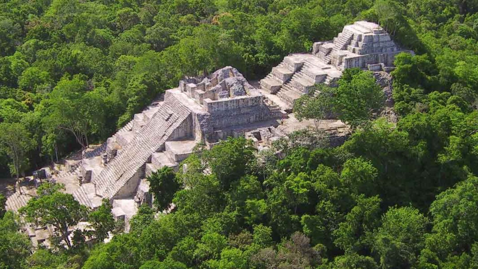
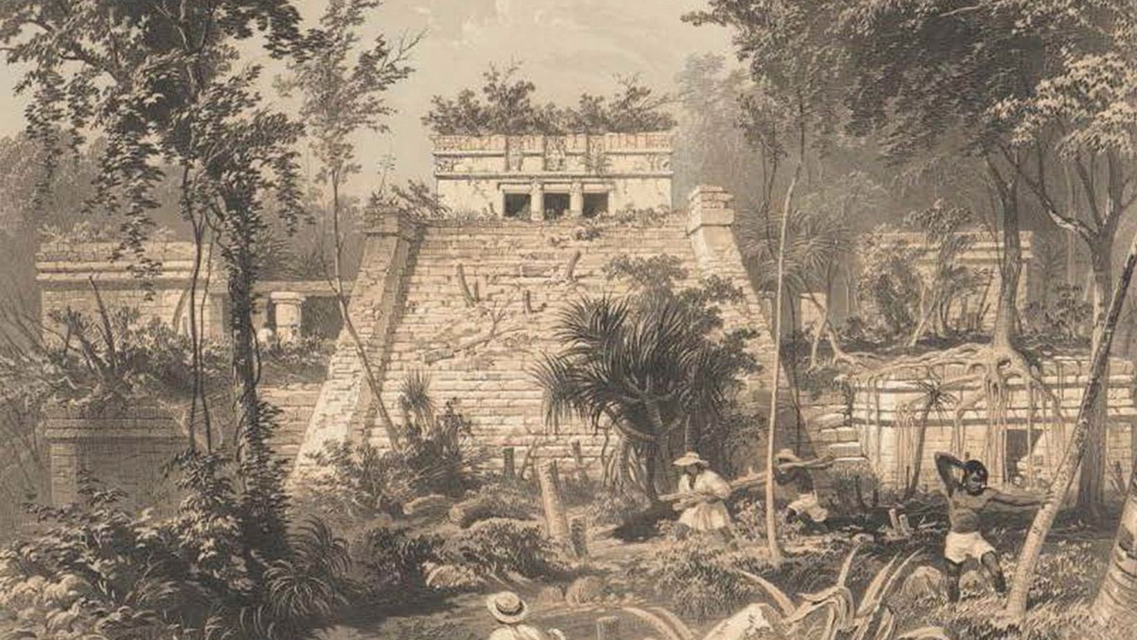
Imagine navigating the dense jungles of Central America and stumbling upon ancient Maya city placement, their grandeur concealed within the verdant canopy. The Maya civilization, renowned for its advanced architecture and rich culture, owes much of its development to the geographical landscape. From the strategic placement of Maya city to their ingenious adaptation to environmental challenges, geography was not just a backdrop but a central player in shaping Maya urbanization. In this blog, we’ll delve into how the Maya’s understanding of their surroundings influenced their city placement, development, and daily life, revealing a civilization deeply intertwined with its environment.
Geographical Features of the Maya Lowlands

The Maya Lowlands, spanning parts of modern-day Mexico, Guatemala, Belize, and Honduras, present a diverse array of geographical features. This region is characterized by its flat terrain interspersed with rolling hills and dense tropical forests. The lowlands are dotted with rivers, such as the Usumacinta and the Belize River, which were essential for transportation and agriculture.
The landscape also includes extensive limestone plains and a network of caves and cenotes. These natural formations played a crucial role in the Maya’s water management systems and were often considered sacred. The combination of fertile soils and a warm, humid climate supported the growth of crops like maize, which was central to Maya sustenance.
Additionally, the lowlands experience a seasonal rainfall pattern, with distinct wet and dry seasons. This variability influenced agricultural practices and settlement patterns. Understanding these geographical features helps explain why the Maya chose specific locations for Maya city and how they adapted to their environment.
The Role of Water Sources: Maya City Placement
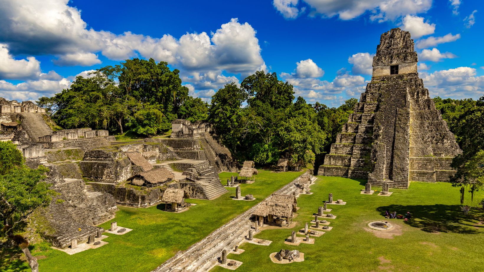
Water was crucial for the Maya civilization, influencing where they chose to settle. Major Maya city were often located near rivers, lakes, or cenotes, natural wells that provided a reliable water supply. For instance, Tikal, one of the largest Maya city, was strategically positioned near numerous natural springs and reservoirs. These water sources supported daily life, agriculture, and rituals.
Maya engineers developed complex systems to manage water resources, such as reservoirs and canals. In arid regions, they constructed rainwater harvesting systems to capture and store rainfall. This ingenuity allowed Maya city placement to thrive even in challenging environments. Without access to water, the development and sustainability of Maya city placement would have been severely limited.
The presence of water also influenced trade and communication. Waterways facilitated transportation and trade between Maya city placement, contributing to the economic growth of the Maya civilization. Thus, water sources were not just vital for survival but also for the prosperity and connectivity of Maya city placement.
Strategic Location of Maya Cities

The Maya carefully chose the locations of their cities based on strategic considerations. Many cities were situated in areas that offered natural advantages, such as defensible positions on elevated ground or near important trade routes. For instance, Tikal was located in a region that allowed control over key trade routes through the lowlands and provided access to vital resources.
Strategic placement also helped protect cities from potential invasions. Elevated sites and natural barriers, such as dense forests or river systems, were used to fortify defenses. The Maya utilized these geographical features to create formidable fortifications, enhancing their security.
Trade was another crucial factor in Maya city placement. Maya cities often grew around major trade routes or near important resources like obsidian or salt. This allowed them to establish economic networks and engage in long-distance trade with neighboring regions, boosting their prosperity.
Overall, the Maya’s strategic city locations were key to their success. By leveraging their understanding of geography, they optimized their cities for defense, trade, and resource management, contributing to their long-lasting influence.
Influence of Topography on Urban Planning: Maya City Placement
The topography of the Maya Lowlands significantly influenced urban planning and city design. Cities were often built on elevated terrain or in natural depressions to take advantage of the landscape’s natural features. For instance, Palenque was constructed in a hilly region, integrating its buildings with the rugged terrain to enhance both aesthetics and functionality.
The Maya adapted their architectural styles to the surrounding topography. In areas with uneven ground, they built terraced platforms to level out construction sites. This approach allowed them to create impressive structures and ceremonial spaces, despite challenging landscapes.
In addition, natural features such as hills and valleys were used to define city boundaries and enhance defense mechanisms. Elevated locations provided better visibility and control over surrounding areas, while valleys offered natural protection against invaders. The Maya’s ability to adapt to and utilize their topography was crucial in shaping their urban environments and infrastructure.
Overall, the topography was not merely a backdrop but an integral factor in how Maya cities were planned and developed. Their sophisticated use of the landscape highlights their advanced understanding of urban design and environmental integration.
Environmental Considerations and Agriculture: Maya City Placement
Environmental factors played a crucial role in Maya agricultural practices and city development. The Maya adapted their farming techniques to the diverse environments of the Lowlands, including dense forests and variable soil conditions. They used advanced methods such as slash-and-burn agriculture to clear land and enrich the soil with nutrients.
To manage water resources, the Maya built extensive irrigation systems and reservoirs. These systems helped sustain crops during dry periods and supported large populations. The Maya also practiced terrace farming on hilly terrain to prevent soil erosion and maximize arable land.
Soil quality and rainfall patterns were critical in determining where to establish agricultural fields. The Maya selected locations with fertile soils and reliable rainfall to ensure productive farming. They also engaged in crop rotation to maintain soil health and productivity.
Overall, the Maya’s environmental adaptations were key to their agricultural success and urban growth. Their ability to effectively manage and utilize their environment allowed them to sustain large cities and complex societies.
Cave Systems and Sacred Geography
Cave systems and cenotes played a significant role in Maya civilization, both practically and spiritually. These natural features provided vital water sources, especially in areas where surface water was scarce. The Maya utilized these caves and cenotes for water storage and as key components of their urban infrastructure.
Beyond their practical use, these geological formations were considered sacred. The Maya believed that caves were entrances to the underworld and sites of divine communication. Many ceremonial activities, including rituals and offerings, took place in or near these sacred spaces.
The layout of Maya cities often incorporated these sacred sites, reflecting their importance in Maya cosmology. Temples and pyramids were frequently constructed close to cenotes or within sight of significant caves. This integration of natural features into urban planning demonstrates the Maya’s deep connection with their environment and religious beliefs.
Overall, cave systems and cenotes were more than just geographical features; they were integral to Maya spiritual life and city planning. Their significance in both practical and religious contexts highlights the Maya’s sophisticated understanding of their landscape.
Trade Routes and Economic Factors: Maya City Placement
Trade routes were crucial to the economic development of Maya cities. The Maya strategically located their cities along important trade routes that connected various regions. This placement facilitated the exchange of goods such as obsidian, jade, and salt, which were highly valued and essential for Maya society.
The Maya built roads and canals to improve trade efficiency. These routes allowed for the movement of goods and people, linking major cities with surrounding areas and beyond. The economic prosperity of many Maya cities was closely tied to their ability to access and control these trade networks.
Trade routes also influenced the growth and development of Maya cities. Cities situated at key intersections of trade routes often experienced rapid growth due to increased economic activity. This connectivity allowed them to become major centers of commerce and culture.
Overall, trade routes were integral to Maya economic and urban development. By positioning their cities along these routes, the Maya were able to maximize their economic potential and enhance their influence across the region.
Climate and Its Effects on Urban Development
The climate of the Maya Lowlands had a profound impact on urban development. The region experiences a tropical climate with distinct wet and dry seasons. This variability influenced agricultural practices and settlement patterns, as the Maya adapted to the cyclical nature of rainfall.
During the wet season, heavy rains were harnessed through sophisticated water management systems, including reservoirs and canals. These systems helped store water for use during the dry season, which was critical for sustaining crops and supporting large populations. The Maya’s ability to manage and utilize water resources was essential for the growth of their cities.
The dry season posed challenges, often leading to drought conditions that affected agriculture and water supply. To mitigate these effects, the Maya employed strategies such as crop rotation and irrigation. The adaptation to climate variations ensured the sustainability of their urban centers and agricultural systems.
Overall, the Maya’s understanding of their climate and its impact on their environment was crucial for urban planning and development. Their innovative solutions to climatic challenges highlight their advanced knowledge and adaptability.
Case Studies of Prominent Maya City Placement
Examining specific Maya cities reveals how geography influenced their development. Tikal, for example, thrived due to its location near vital water sources and trade routes. Its extensive reservoir system managed the city’s water needs and supported its large population.
Copán, situated in a hilly region, utilized its topography for defense and religious purposes. The city’s layout incorporated natural features, such as the nearby river and surrounding hills, which enhanced its strategic position. The Maya built impressive structures on terraces to adapt to the uneven terrain.
Palenque, another prominent city, is known for its integration with the surrounding landscape. Its location in a dense jungle area presented challenges, but the Maya adapted by constructing elevated platforms and utilizing natural water sources like nearby springs. This allowed Palenque to flourish despite its challenging environment.
These case studies illustrate how the Maya tailored their urban planning to their geographical settings. Each city’s unique location and environmental factors shaped its development, infrastructure, and overall success. Understanding these adaptations provides insight into the sophistication of Maya urban planning.
Decline and Abandonment of Maya Cities: Maya City Placement

The decline and abandonment of many Maya cities were influenced by a range of geographical and environmental factors. Prolonged droughts significantly impacted agricultural productivity, leading to food shortages and weakened economies. These climatic changes disrupted the delicate balance of resources that Maya cities relied upon for their survival.
Deforestation also played a role in the decline. As the Maya cleared forests for agriculture and construction, soil erosion increased and agricultural yields decreased. This environmental degradation made it more difficult for cities to sustain their large populations.
Social and political factors further compounded these challenges. Internal conflicts and competition between city-states contributed to instability and could have accelerated the abandonment of certain urban centers. In many cases, the combination of environmental strain and social upheaval led to the gradual decline and eventual abandonment of Maya cities.
Overall, the interplay between environmental conditions and societal factors led to the decline of the Maya civilization. Understanding these dynamics helps explain why many once-thriving cities were eventually deserted.
Conclusion: Maya City Placement
Geography was a fundamental factor in the development and sustainability of Maya city placement. From strategic placement along trade routes to the management of water resources and adaptation to topography, the Maya used their understanding of the environment to their advantage. Maya city placement were carefully planned to maximize resources and minimize challenges posed by the landscape. Despite eventual declines due to environmental and social pressures, the Maya’s sophisticated use of geography highlights their advanced planning and adaptability. Their ability to integrate natural features into urban design offers valuable insights into their ingenuity and resilience.
FAQs
How did the Maya manage their water supply during the dry season?
The Maya managed their water supply through an extensive network of reservoirs and canals. They built large storage tanks to collect and hold rainwater, which was then distributed throughout the Maya city placement. This system ensured a steady water supply even during prolonged dry periods.
What were some key materials traded by the Maya, and how did geography affect this trade?
The Maya traded materials like obsidian, jade, salt, and textiles. Their geographical placement along major trade routes facilitated the exchange of these goods. Maya city placement at trade crossroads or near valuable resources thrived as commercial hubs, enhancing their economic and cultural influence.
Why were cenotes considered sacred by the Maya?
Cenotes were considered sacred because they were believed to be portals to the underworld and sites of divine communication. The Maya used these natural wells for religious ceremonies, offerings, and rituals, viewing them as a connection between the human world and the spiritual realm.
How did the Maya adapt their agriculture to different environmental conditions?
The Maya adapted their agriculture by using various techniques suited to their environment. In areas with rich soil, they practiced traditional farming methods, while in less fertile regions, they used slash-and-burn techniques and terrace farming to manage soil fertility and prevent erosion.
What were some of the most significant challenges faced by the Maya in maintaining their cities?
Significant challenges included managing water resources during droughts, dealing with soil erosion and deforestation, and addressing internal conflicts. These factors combined to strain the resources and stability of Maya cities, contributing to their eventual decline and abandonment.

