


The Piri Reis Map is a fascinating artifact that has captured the imagination of historians and explorers alike. Created in 1513 by the Ottoman admiral and cartographer Piri Reis, this map reveals a stunningly accurate depiction of the coastlines of South America and parts of Africa. What makes it even more intriguing is its controversial representation of Antarctica, a landmass that was not officially discovered until centuries later. This map holds significant importance in historical cartography, challenging our understanding of early navigation and the extent of knowledge possessed by ancient civilizations. Let’s dive deeper into its mysteries!
Historical Background
Piri Reis was an Ottoman admiral, navigator, and cartographer born around 1470 in modern-day Turkey. He gained fame for his contributions to maritime exploration during the Age of Discovery. His most notable work, the Piri Reis Map, was created in 1513, showcasing not only his skills as a mapmaker but also his extensive knowledge of geography and navigation. Reis compiled information from various sources, including previous maps and the accounts of explorers, reflecting the collaborative nature of map-making during this time.
In the 16th century, map-making was evolving rapidly due to advancements in navigation and exploration. European powers were expanding their empires, leading to an increased demand for accurate maps. The introduction of printing technology also revolutionized how maps were produced and distributed. However, many maps, including those by Piri Reis, were still based on a mix of firsthand accounts and speculative knowledge, resulting in some inaccuracies and unique interpretations of the world. This context highlights the significance of the Piri Reis Map as a blend of art, science, and exploration in an era of discovery.
Description of the Piri Reis Map

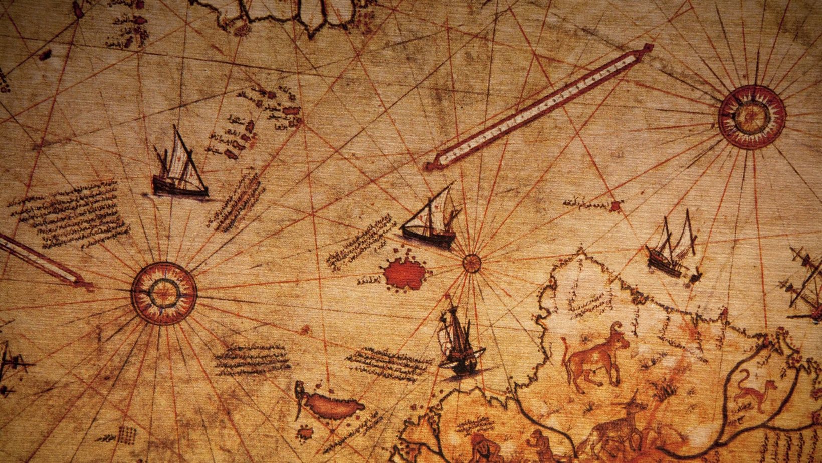
The Piri Reis Map is renowned for its intricate design and vivid details. Measuring approximately 70 cm by 100 cm, it is a world map that displays a portion of the Western Hemisphere, including parts of Europe, Africa, and South America. The map features elaborate illustrations, including ships, sea monsters, and decorative borders, showcasing Piri Reis’s artistic skill. The use of colors and shading gives a sense of depth and highlights the map’s geographical features.
One of the most notable aspects of the Piri Reis Map is its representation of the coastlines of South America and the unique portrayal of Antarctica, which was not officially discovered until centuries later. The map also includes annotations in Turkish, offering insights into the navigational routes and geographic knowledge of the time. Piri Reis referenced multiple earlier maps, including those from ancient Greek, Arabic, and even Chinese sources, demonstrating a synthesis of knowledge across cultures. The Piri Reis Map stands as a testament to the intricate relationship between art and science in the age of exploration.
Mysteries Surrounding the Map
The Piri Reis Map is filled with anomalies that have puzzled historians and cartographers for centuries. One major mystery is its surprisingly accurate depiction of the coast of South America and the Caribbean, especially considering the limited exploration of these areas at the time. However, the map also contains inaccuracies, such as the bizarre representation of the Antarctic coastline, which raises questions about how Piri Reis obtained his information. Some believe that these discrepancies suggest the use of ancient, possibly lost, maps that depicted regions not known to later explorers.
Speculations abound regarding the sources Piri Reis used for his map. He claimed to have referenced over twenty different maps, some of which were much older and possibly derived from ancient civilizations. The idea that pre-Columbian societies possessed detailed knowledge of the world, including Antarctica, has fueled theories of advanced ancient civilizations. Some even suggest that these ancient navigators could have mapped the continent before it was covered in ice. These mysteries invite further investigation and discussion about the extent of historical knowledge and the capabilities of ancient societies.
Antarctica: The Frozen Continent
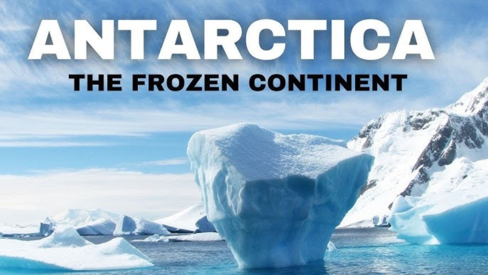
Antarctica is the southernmost continent on Earth, characterized by its vast ice sheets and extreme cold. It covers an area of about 14 million square kilometers, making it the fifth-largest continent. The landscape is dominated by ice, which holds around 70% of the world’s fresh water. Despite its harsh conditions, Antarctica is home to unique ecosystems, including species like penguins and seals that have adapted to the icy environment.
Historical exploration of Antarctica began in the early 19th century. The continent remained largely uncharted until explorers like James Cook ventured into its waters in the late 1700s. Cook’s expeditions helped to map the surrounding seas but did not reach the land itself. It wasn’t until the early 20th century that significant land expeditions took place, with figures like Ernest Shackleton and Robert Falcon Scott leading famous journeys. Their explorations laid the groundwork for understanding Antarctica’s geography and its significance to global climate and ecology. Today, Antarctica continues to be a focus of scientific research, revealing critical information about climate change and Earth’s history.
Theories of Ancient Civilizations
The Piri Reis Map has sparked numerous theories about connections to lost civilizations that may have had advanced geographical knowledge. Some researchers suggest that the map’s accuracy in depicting coastlines, including parts of Antarctica, indicates that ancient cultures possessed information not known to later explorers. These theories posit that civilizations like the Maya or Inca might have had navigational skills that extended beyond what is documented. Such claims challenge our understanding of their capabilities and raise questions about the extent of their maritime knowledge.
Additionally, some scholars argue for the possibility of pre-Columbian civilizations having explored Antarctica. The map shows a landmass that appears to represent Antarctica’s coastline, suggesting that it might have been documented before it was covered in ice. The notion of ancient mariners traveling to the southern continent has intrigued many, although evidence remains sparse. These theories highlight the potential for undiscovered links between ancient cultures and a broader understanding of global exploration. While mainstream historians often view these ideas with skepticism, they encourage ongoing investigation into the potential knowledge and skills of ancient societies.
Scientific Investigations
Modern studies related to the Piri Reis Map have employed various scientific methods to analyze its accuracy and origins. Researchers use techniques like digital imaging and computer analysis to enhance the map’s features, making it easier to study the intricate details. This technological approach allows scholars to compare the Piri Reis Map with contemporary satellite images and modern cartographic data. Such comparisons help identify any geographic anomalies and assess the map’s accuracy.
Another significant aspect of these investigations is the use of geospatial technology, including Geographic Information Systems (GIS). GIS enables researchers to overlay the map onto current geographic data, revealing how well it aligns with today’s understanding of the world’s geography. Additionally, scholars conduct material analysis to examine the inks and pigments used in the map, providing insights into the materials and techniques of the 16th century. These modern scientific investigations enhance our understanding of the Piri Reis Map, helping to validate its historical significance and explore its implications for ancient navigation and cartography. The combination of traditional scholarship and modern technology offers a comprehensive approach to uncovering the map’s mysteries.
Cultural Impact and Influence
The Piri Reis Map has made a notable impact on popular culture, inspiring various works in literature, film, and art. Its mysterious origins and depiction of Antarctica have captured the imagination of writers and creators. Many novels, such as “The Lost City of Z” by David Grann, reference the map as a symbol of ancient knowledge and exploration. These stories often weave in themes of lost civilizations and forgotten histories, reflecting the intrigue surrounding the map.
In film and television, the Piri Reis Map has appeared in documentaries and adventure series that explore its significance. Shows like “Ancient Aliens” have discussed the map’s peculiarities, suggesting links to extraterrestrial influence or advanced ancient civilizations. These interpretations, while controversial, showcase the map’s ability to provoke curiosity and debate about our understanding of history. The map’s visual elements, including its intricate designs and exotic illustrations, have also influenced artists and designers, appearing in various art pieces that reflect themes of exploration and mystery. Overall, the Piri Reis Map serves as a powerful cultural artifact, inspiring a diverse array of interpretations and narratives that continue to resonate with audiences today.
Critiques and Controversies
The Piri Reis Map has not escaped skepticism and controversy regarding its significance and accuracy. Many historians and cartographers question the validity of claims suggesting that the map depicts Antarctica before it was covered by ice. Critics argue that the map’s inaccuracies and anomalies can be attributed to the limited geographic knowledge of the 16th century. They emphasize that many features on the map may have been approximated based on other sources rather than firsthand exploration.
Debates among scholars often focus on the origins of the map’s information. Some contend that Piri Reis drew from ancient sources, while others believe the map relies heavily on the navigational knowledge of his time. This divergence of opinions creates a lively discourse about the intersection of mythology, history, and cartography. Additionally, some critics suggest that the map’s portrayal of landmasses could be the result of artistic license rather than an attempt at accurate representation. As such, while the Piri Reis Map is celebrated for its historical value, it remains a topic of contention, provoking both admiration and skepticism within academic circles.
Legacy of the Piri Reis Map

The legacy of the Piri Reis Map continues to influence ongoing research and discoveries in the field of historical cartography. Scholars and researchers are continually exploring the map to uncover more about its origins and the navigational techniques used by ancient mariners. Its unique depiction of landmasses has prompted investigations into the possibility of lost civilizations possessing advanced geographical knowledge. Each new study adds layers to our understanding of how ancient cultures interacted with their environment.
Furthermore, the map serves as a critical piece in the puzzle of understanding ancient navigation methods. It reflects the synthesis of information from various sources, showcasing the navigational skills of 16th-century explorers. The Piri Reis Map provides insights into the maritime routes that might have been used long before modern navigation systems. This understanding helps us appreciate the complexities of sea travel in the past, highlighting the ingenuity of early navigators. Overall, the Piri Reis Map remains a significant artifact, influencing both academic research and popular imagination regarding ancient exploration and the history of cartography.
Conclusion: The Piri Reis Map
The Piri Reis Map continues to captivate scholars and enthusiasts alike, highlighting enduring mysteries that challenge our understanding of history and geography. Its intriguing depictions raise questions about ancient knowledge and navigation, suggesting that our ancestors may have possessed insights we have yet to fully comprehend. As researchers delve deeper into its complexities, the map serves as a reminder of the fluidity of historical narratives and the potential for lost knowledge. Ultimately, the Piri Reis Map invites us to explore the intersections of cartography, culture, and exploration, expanding our appreciation for the legacies of the past.
FAQs
What is the Piri Reis Map, and why is it significant?
The Piri Reis Map is a world map created in 1513 by Ottoman admiral Piri Reis. It is significant because it is one of the oldest maps to depict parts of the Americas and includes notable details about the coastlines of Europe and Africa. Its accuracy and anomalies have sparked considerable interest among historians and cartographers.
How was the Piri Reis Map created?
Piri Reis compiled the map using various sources, including earlier maps, explorers’ accounts, and personal observations. He synthesized this information to create a navigational tool that reflected the knowledge of his time.
What are the key features of the Piri Reis Map?
The Piri Reis Map features intricate illustrations, detailed coastlines, and annotations in Turkish and Arabic. It notably includes depictions of South America, the Caribbean, and parts of North Africa, showcasing a blend of artistic representation and geographical information.
How has the Piri Reis Map influenced modern cartography?
The Piri Reis Map has influenced modern cartography by highlighting the importance of integrating various sources of information in map-making. Its unique characteristics challenge contemporary understandings of early navigation and encourage further exploration of historical cartographic methods.
Are there any myths associated with the Piri Reis Map?
Yes, various myths surround the Piri Reis Map, particularly regarding its depiction of Antarctica. Some theories suggest it shows the continent before it was covered by ice, leading to speculation about lost civilizations and advanced ancient knowledge. These myths often blur the lines between historical fact and fiction, sparking both fascination and skepticism.